When Cyclone Mandous made landfall near Mamallapuram on the night of December 9, 2022, it didn’t just bring wind—it brought water. By dawn, Chennai was underwater in places, streets turned to rivers, and four lives had been lost. The storm, whose name means "treasure chest" in Arabic, had been quietly gathering strength over the Bay of Bengal for days, but few expected the sheer volume of rain it would dump on one of India’s most vulnerable coastal cities. What followed wasn’t just a cyclone—it was a slow-motion flood disaster, unfolding over hours, not minutes.
Landfall and Immediate Impact
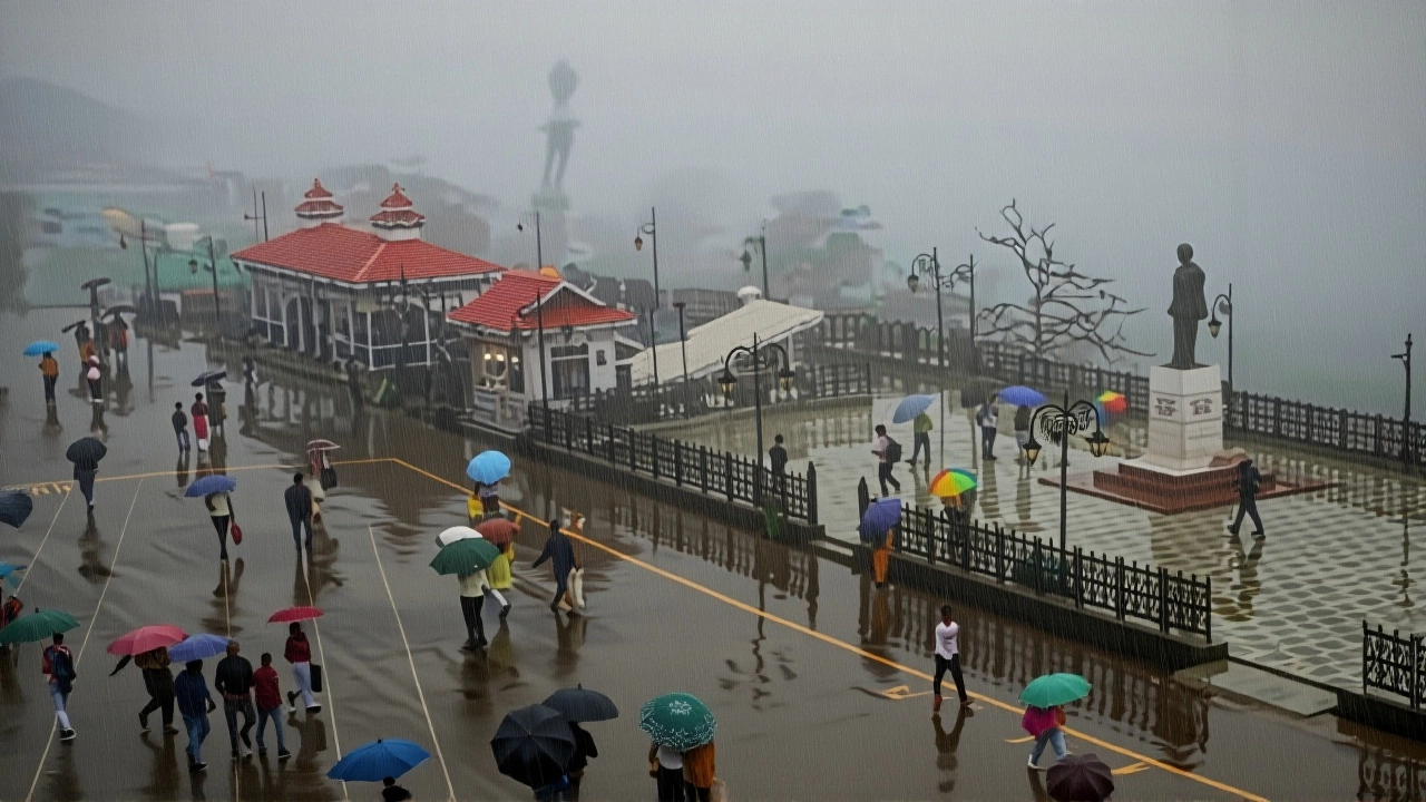
Cyclone Mandous crossed the Tamil Nadu coast just after midnight, with sustained winds of 70 km/h, according to Chief Minister M. K. Stalin. It wasn’t the strongest storm on record, but it was the kind that kills not with fury, but with persistence. The India Meteorological Department (IMD) had warned of heavy rainfall for days, yet the numbers still stunned: 115 millimeters of rain fell in Chennai alone—nearly half the city’s average December rainfall—in just 24 hours. In Arumbakkam’s MMDA Colony, water rose to rooftop level. Cars floated. Power lines snapped. And for those who didn’t evacuate, the sound of rushing water became the only thing louder than their fear.
Emergency Response Under Pressure
By Friday afternoon, Tamil Nadu State Disaster Management Authority had deployed 40 specialized rescue teams, 16,000 police personnel, and 1,500 home guards. Five thousand relief camps were set up across coastal districts—schools, community halls, even temples became shelters. The state’s preparedness was visible: no major infrastructure collapse, no chaotic evacuations. But the human cost was still there. Four deaths were confirmed: two from electrocution after wading through flooded streets, one from a falling tree, and another from drowning in a submerged home. "We saved thousands," said a relief officer near Kancheepuram. "But every time we pull someone out, we wonder who we missed."
Why Mandous Was So Destructive
What made Mandous different wasn’t its wind speed—it was its patience. Unlike fast-moving cyclones that burn out quickly, Mandous crawled. It moved at just 15–20 km/h, dragging moisture from the Bay of Bengal like a sponge. This slow pace meant it dumped rain over the same areas for hours. "It’s not the hurricane that kills you," explained Dr. R. Srinivasan, a climate researcher at the Indian Institute of Technology Madras. "It’s the monsoon that won’t leave. Mandous didn’t just bring rain—it extended the monsoon." The IMD had predicted this behavior: Mandous was expected to weaken into a deep depression by Saturday, but its lingering moisture continued triggering flash floods across Puducherry and parts of Andhra Pradesh through Sunday.
A Naming System Rooted in Regional Cooperation
The name "Mandous" didn’t come from a meteorologist’s spreadsheet—it came from the United Arab Emirates. Since 2000, eight countries around the North Indian Ocean—India, Bangladesh, Sri Lanka, Pakistan, Maldives, Oman, Myanmar, and Thailand—have taken turns naming cyclones. Each submits a list of 13 names, chosen to reflect local culture, history, or nature. Mandous, meaning "treasure chest," was submitted by the UAE, perhaps ironically, given the destruction it caused. The system, coordinated by the World Meteorological Organization, avoids Western names and ensures regional ownership. "It’s not just a label," said Dr. Anjali Sharma, a meteorologist at the IMD. "It’s a reminder that these storms don’t respect borders. We name them together because we suffer them together."

What’s Next for Coastal India?
For Tamil Nadu, the immediate concern is clean-up and disease prevention. With stagnant water still pooled in low-lying areas, health officials are bracing for outbreaks of leptospirosis and dengue. Schools and colleges remain closed through December 12. The state has already requested ₹1,200 crore in central aid for reconstruction. But the bigger question lingers: Why do we keep rebuilding in the same flood-prone zones? Chennai’s drainage system, designed for a city half its current size, collapsed under the weight of Mandous. The same happened in 2015, when a cyclone killed 500. The pattern is clear. And yet, construction continues unchecked along the coast.
Behind the Numbers: A Climate Pattern Emerges
Between 2018 and 2022, the Bay of Bengal produced five cyclones with names—Fani, Amphan, Gati, Nivar, and now Mandous. Four of them hit Tamil Nadu or Puducherry. Scientists say warming sea surface temperatures—up 1.2°C since 1980—are fueling more moisture-laden storms. What used to be a "once-in-a-decade" event is now happening every 18 months. "We’re not just seeing more storms," said Dr. Sharma. "We’re seeing storms that behave differently. Slower. Wetter. Harder to predict." The IMD now uses AI-driven models to track these changes, but infrastructure hasn’t kept pace. In Karaikal, fishermen say the sea has been encroaching 3 meters a year. No one’s building seawalls.
Frequently Asked Questions
How many people were affected by Cyclone Mandous in Tamil Nadu?
Over 350,000 people were directly affected, with more than 5,000 relief camps housing displaced families. Around 12,000 homes suffered partial or complete damage, especially in coastal districts like Cuddalore, Nagapattinam, and Chennai. Nearly 1,000 villages reported power outages, and 200 roads were washed out, isolating communities for days.
Why was Chennai hit so hard despite early warnings?
While warnings were accurate, Chennai’s aging infrastructure couldn’t handle the volume. Drainage systems built in the 1980s were clogged with plastic and debris. Many low-income neighborhoods, like Arumbakkam, sit below sea level with no pumping capacity. The city’s rapid urbanization—over 100 square kilometers of wetlands lost since 2000—meant rainwater had nowhere to go. Early warnings save lives, but they can’t fix broken pipes.
What role did the India Meteorological Department play in managing the crisis?
The IMD issued its first alert on December 5, tracking Mandous’s formation and path with 90% accuracy. They issued red alerts for six districts, coordinated with state authorities, and sent real-time updates via SMS and social media. Their forecasting helped prevent a higher death toll—despite the storm’s intensity, the death count was lower than in 2015. But experts say the IMD needs more funding for local weather stations, especially in remote coastal villages.
Is Cyclone Mandous linked to climate change?
Yes. Sea surface temperatures in the Bay of Bengal rose to 30.5°C during Mandous’s formation—well above the 28°C threshold for cyclone intensification. Studies from the Indian Institute of Science show that the frequency of severe cyclones in the region has doubled since 2000. Mandous wasn’t an anomaly—it was a trend. Slower-moving, rain-heavy storms are becoming the new normal, and India’s coastal cities are still unprepared.
How are cyclones named in the North Indian Ocean?
Eight countries—India, Bangladesh, Sri Lanka, Pakistan, Maldives, Oman, Myanmar, and Thailand—each submit 13 names to a rotating list. The names are culturally relevant and avoid religious or offensive terms. When a cyclone forms, the next name on the list is used. Mandous was contributed by the UAE. The system, managed by the WMO since 2000, promotes regional cooperation and helps communities connect emotionally to storms they’re warned about.
What’s being done to prevent future disasters like this?
The Tamil Nadu government has approved a ₹500-crore Coastal Resilience Plan, including drainage upgrades, mangrove restoration, and elevated housing for vulnerable communities. But implementation is slow. NGOs like the Centre for Science and Environment are pushing for mandatory flood zoning laws. Without structural changes—like banning construction in floodplains and reviving wetlands—future cyclones will keep rewriting the same tragedy.